
Maptivate delivers enhanced experiences at Territory parks
Visitors to two of the Northern Territory’s most loved attractions — the George Brown Darwin Botanic Gardens and the Territory Wildlife Park – can now enjoy a new way to explore using their new interactive maps.
Nearly half a million people visit the George Brown Darwin Botanic Gardens each year, making it one of Darwin's most popular attractions.
Launched over the weekend by the Northern Territory’s Minister for Tourism and Hospitality and the Minister for Parks and Wildlife, the Hon. Marie-Clare Boothby MLA, the new maps give visitors easy, on-demand access to information about attractions, amenities, and stories within each park.
“We said we would make it easier for people to find and experience the Territory’s major tourism icons, through better promotion and smarter digital tools, and that’s exactly what this delivers,” Minister Boothby said in the Government’s media release.
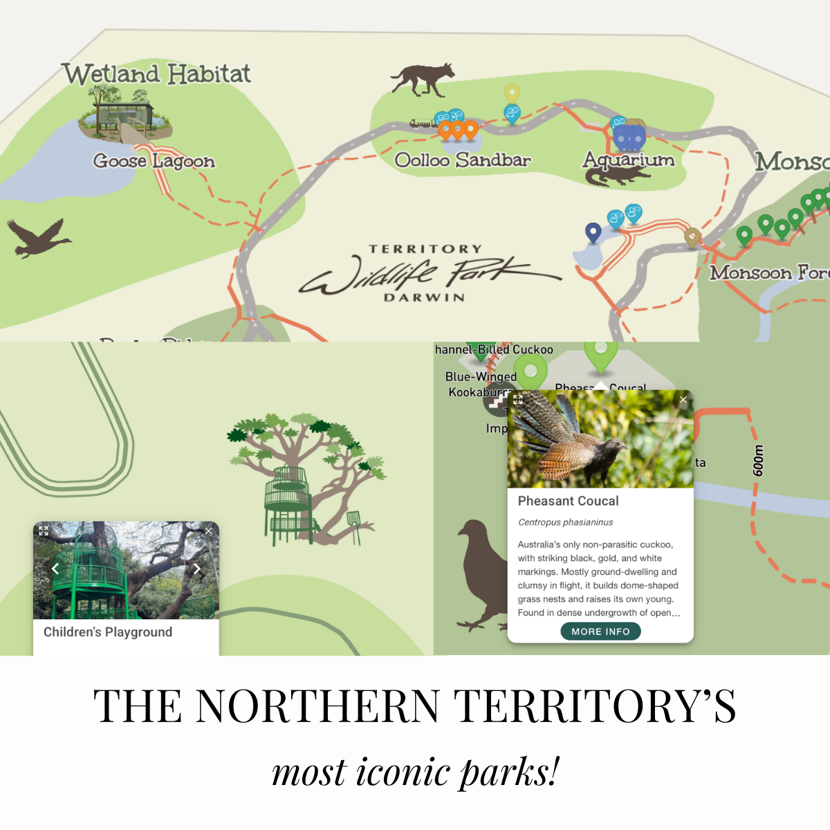
As with all of our maps — the NT interactive maps are accessed via any web browser through a simple QR code. It provides way finding, exploring, and instant language translation at the click of a button.
🌟 New feature:
We are also excited to launch a brand new feature that has been included across both maps. Visitors can learn about and engage in conservation through the Conservation Status feature. The maps show both the habitat map and conservation status of each species on the map, sourced from The Atlas of Living Australia.
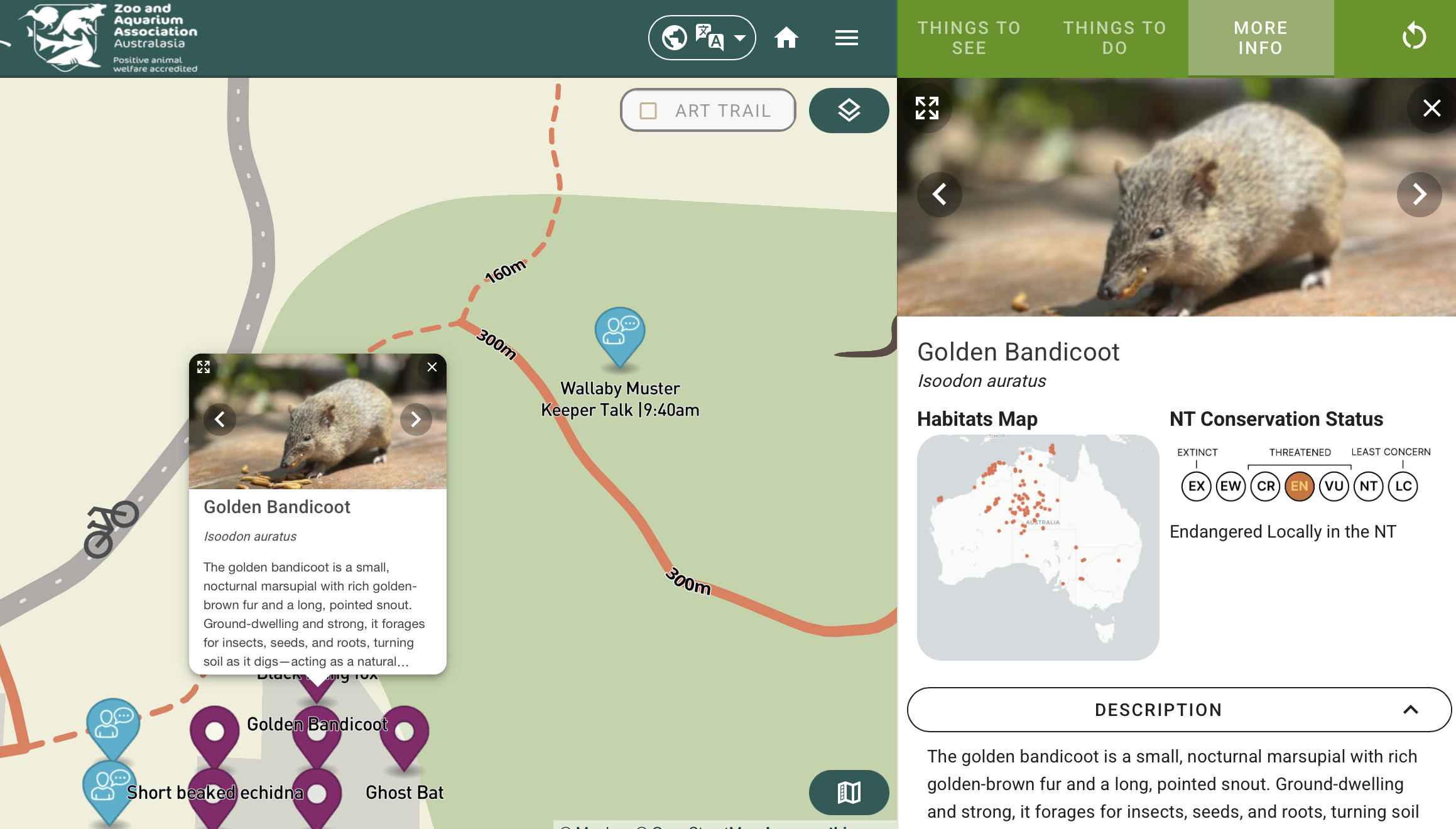
The Golden Bandicoot as featured on the Territory Wildlife Park map.
This new feature plays a central role in advocating for important conservation programs and initiatives at each park and garden, encouraging visitor engagement with these issues and inspiring tangible action.
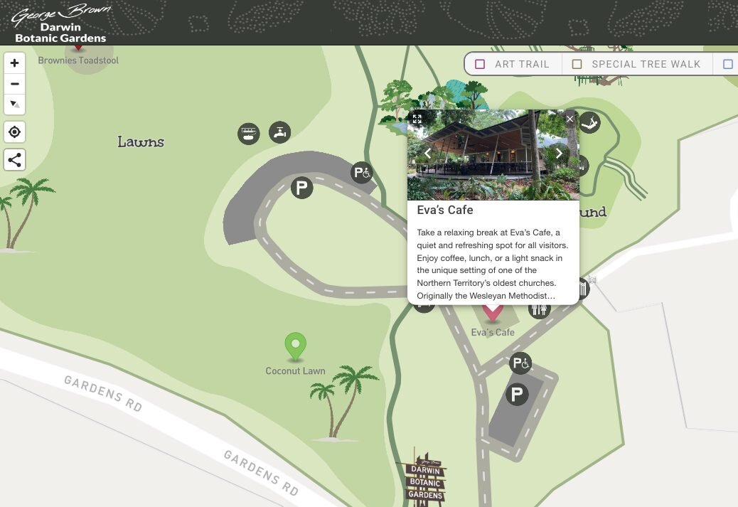
Local café operator, Jason Hanna from Eva’s Café, located within the George Brown Darwin Botanic Gardens, said wayfinding was one of the most common questions staff dealt with every day.
It’s rewarding to see how Maptivate’s technology is helping visitors experience these cherished parks in new, accessible ways.
Whether you’re a local grabbing a coffee at Eva’s Café or a first-time visitor discovering the Territory’s unique wildlife, the maps make navigation easy and effortless. Real-time way finding shows your position as you move, while multi-language support ensures every visitor feels at home.
We love the Friends reference from Mr Hanna who said that digital map “actually shows you which way you’re facing, so you can stand in the map and know where you’re going — a bit like Joey and Chandler from Friends.” No need to step into the pop-up map, Joey!
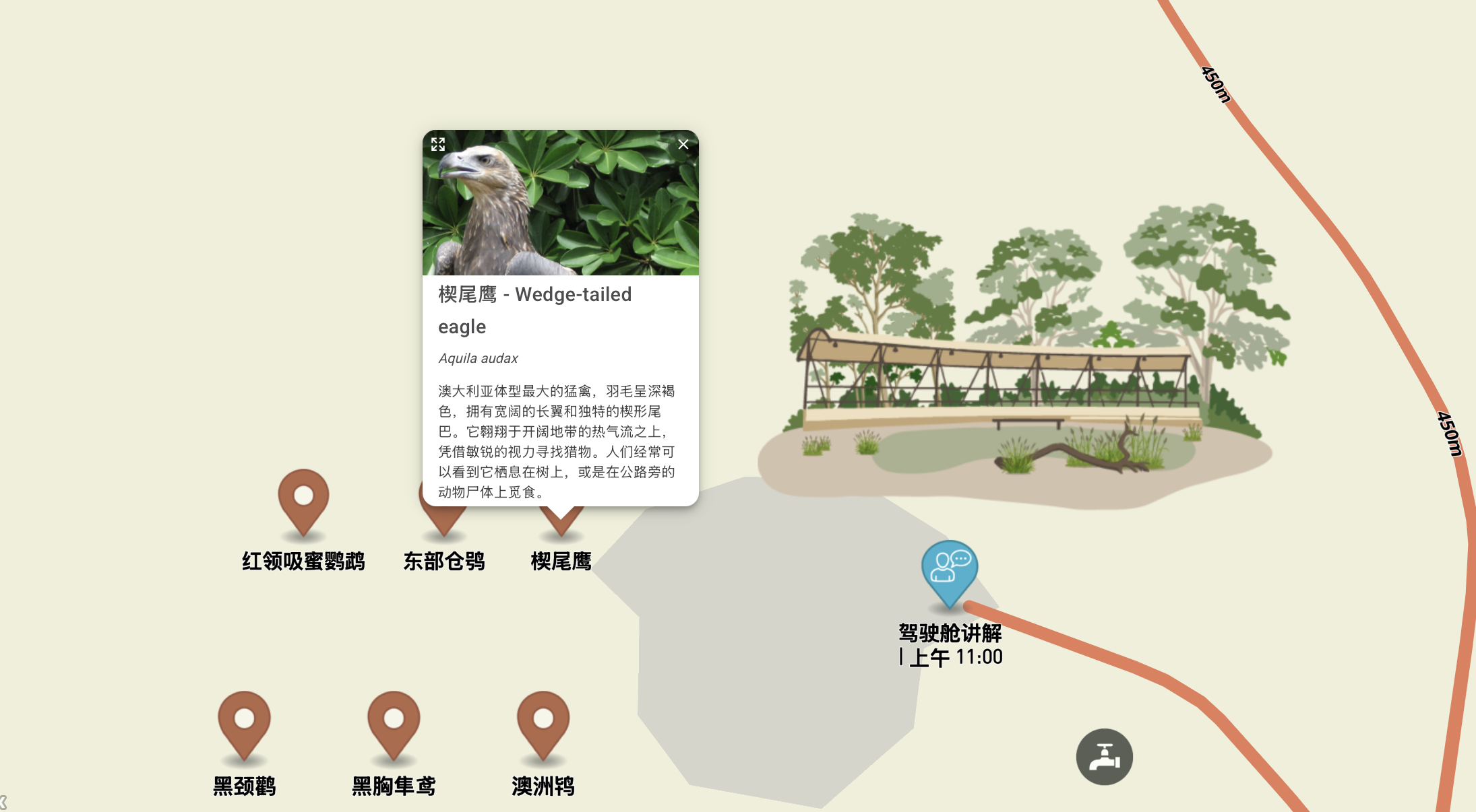
The maps are available in over 30 languages, supporting both domestic and overseas travellers.
For Maptivate, this project represents the heart of what we do — using digital storytelling and interactive mapping to enhance experiences and connect people more deeply and effortlessly with places, stories, and conservation initiatives.
The rollout will continue in March 2026, when Alice Springs Desert Park launches their map — bringing even more opportunities to enrich visitor experiences across the NT!
Explore the maps here:
🌺 George Brown Darwin Botanic Gardens
🐾 Territory Wildlife Park
Media highlights here:
This article draws upon the Northern Territory Government media release, “Smarter maps, better experiences at iconic Territory parks,” issued by the Hon. Marie-Clare Boothby MLA, Minister for Tourism and Hospitality and Minister for Parks and Wildlife, on 24 January 2026.