
Bringing community spaces to life with Maptivate
Chris Bulford presents at the Parks and Leisure Australia National Conference, exploring how interactive mapping tools can help local governments transform their public assets into vibrant community hubs.
The challenge
Councils across Australia manage a wide variety of public assets - from parks and playgrounds to bush reserves, historic landmarks, public art and more! In this digital age, and as urban environments continue to evolve, communities expect easy and real-time access to information.
With a diverse community, this can be challenging. For example, 23% of Australians speak a language other than English at home; and 18% have a registered disability.
The challenge is, how can local governments ensure accessibility and enhance community engagement with their public assets and initiatives?
At last week’s Parks and Leisure Australia National (PLA) Conference in Hobart, Chris Bulford, Managing Director of Maptivate, presented a solution to this challenge - one that empowers councils with intuitive and interactive mapping and storytelling tools to help them transform their public assets into vibrant, inclusive community hubs.
The theme of this year’s conference was ‘Inspired by the Past - Visions for the Future’ . It invited bold ideas for re-imagining the future of community spaces and recreation.
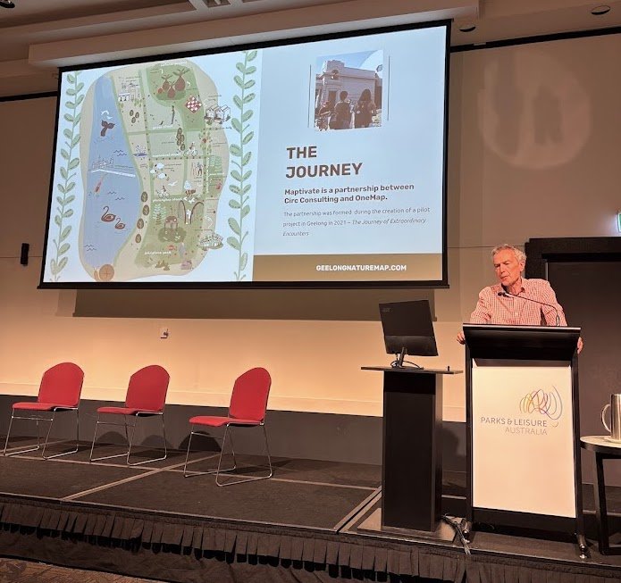
Chris Bulford, Managing Director of Maptivate, presents at the Parks and Leisure Australia National Conference in Hobart, alongside Aaron Sims, Lead Developer.
The solution
Councils are empowered to create a custom built and designed interactive map of the local area to plot its shared assets, community spaces, and Council-led initiatives and events.
Once the map is established, Councils can manage and update the information and content displayed on the platform themselves, in real-time, using their own Content Management System (CMS).
As a GIS-enabled platform, residents and visitors alike can navigate the neighbourhood, easily search for information and map points, and watch videos and learn stories. There are accessibility and sensory-awareness features on the map for community members with diverse needs, as well as a live language translation feature.
These innovations make spaces more discoverable, usable, and connected through the platform.
Why is this important?
As Chris Bulford shared: “When more people spend meaningful time in shared spaces, the benefits ripple outwards - helping to build stronger social connections and supporting improved physical, mental, and emotional health within the community.”
By harnessing the power of interactive mapping and storytelling, interactive mapping tools like Maptivate can help local governments bring community spaces to life.
Examples
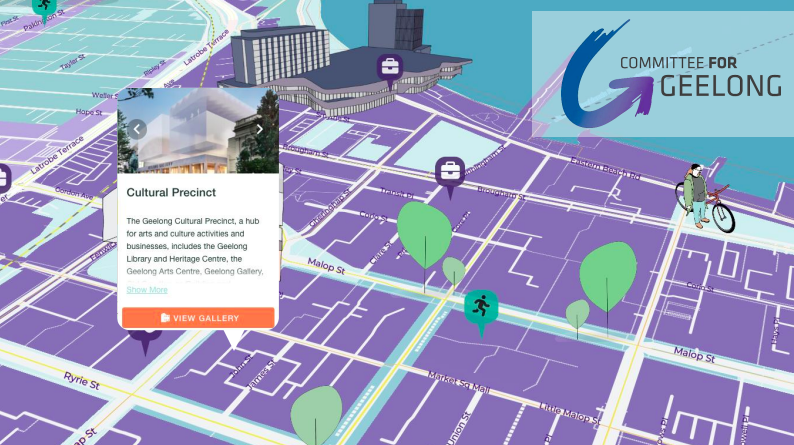
The Committee for Geelong
The Committee for Geelong launched their ‘Future Geelong’ Maptivate map - envisioned as the blueprint for the city’s growth and development paths.
The map captures the prospectus for the transformative changes necessary to support a thriving and resilient Geelong city region at a population of 1 million people.

City of Greater Dandenong
The City of Greater Dandenong’s Digital Art Trail for Noble Park uses Maptivate to highlight art, hidden gems, and historic stories throughout Noble Park.
The map of Noble Park’s Digital Art Trail is designed by artist Sasha Heath.

Open House Melbourne
Another exciting use case is Open House Melbourne’s Access Map for 2025, featuring mobility-friendly and neurodiverse-considerate sites for their 2025 program. It helps users find nearby amenities and plan their attendance.
Are you a council interested in working with us?
You can see Maptivate in action by scheduling a demo and discovering how interactive digital mapping can transform your shared assets into inclusive, engaging community spaces.